Current location:
Home
> News > Product News > Interactive Flat Panel
 Release date: 2026-09-29
 Clicks:0
From GIS maps, video surveillance and meteorological data, to event analysis, resource scheduling and emergency drills, analyze how interactive whiteboards help command teams form a unified situation map and push actions to the ground.
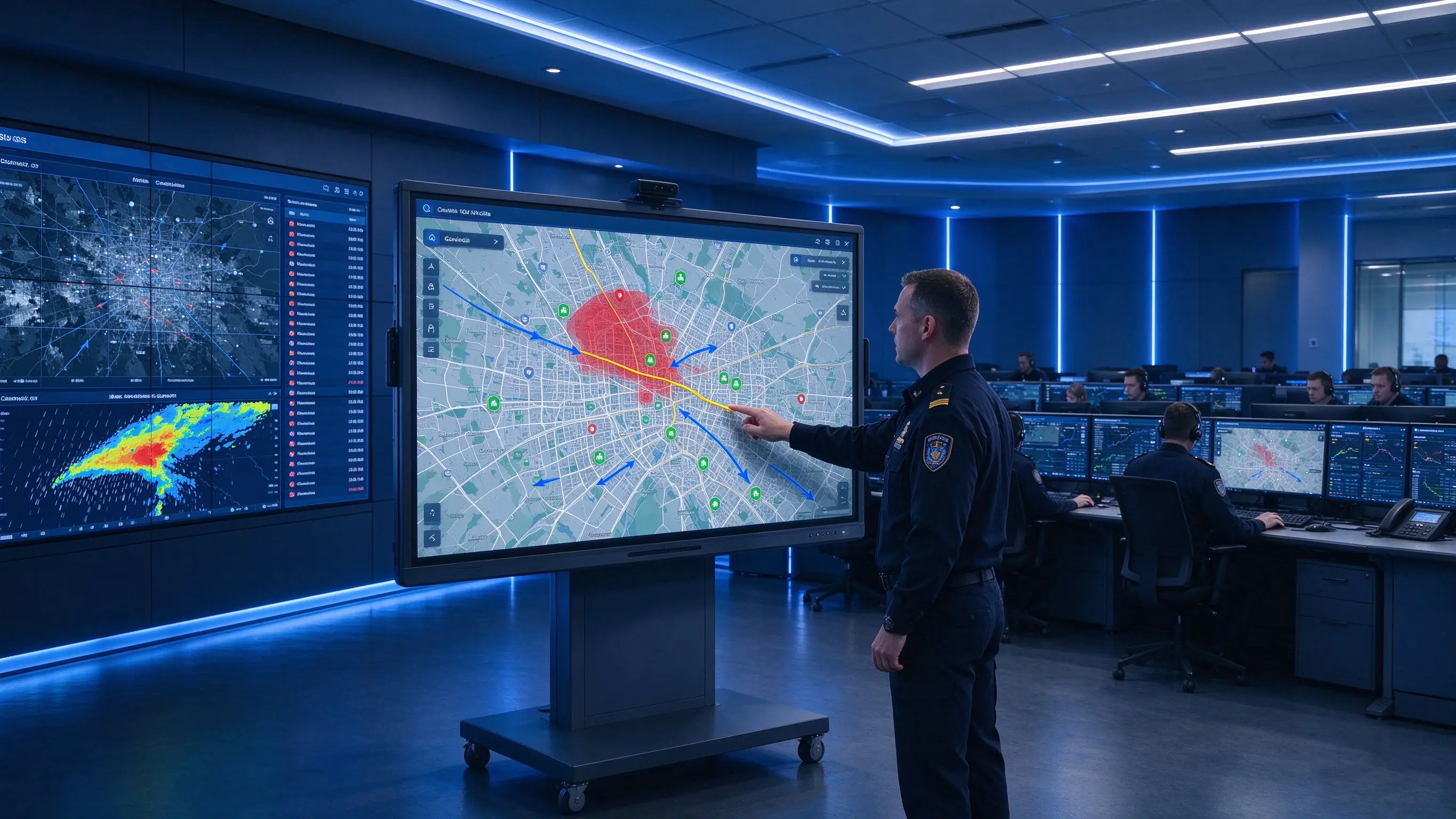
In an emergency event, the command center needs to view the GIS map, live video, weather warning, alert information and resource location at the same time. The public security, fire, medical, transportation and public works departments provide different information. The traditional video wall can display multiple pictures, but the commander still needs to complete the sorting through oral communication. Important risk points, resource scheduling and action boundaries may be scattered in paper, notes and personal notes. It is not easy to resume the exercise and decision-making process after the incident.
The large screen of the emergency command center should not be just an information playback wall, but a workspace for the team to observe, analyze, plan and resume. FEMA sees visual displays, GIS, incident management platforms, and collaboration tools in public safety EOCs as important components to support unified situational awareness, noting that maps, dashboards, kanban boards, and digital whiteboards can all serve incident coordination [reference:0].
Qtenboard (Shenzhen Qunmao)Founded in 2005, we have been dedicated to interactive display manufacturing for 20 years. We operate a 330,000㎡ smart manufacturing industrial park in Shenzhen and Guangzhou, featuring eight fully automated production lines with a daily output capacity of 200 units. Our solutions serve 120 countries and regions worldwide, and we have provided services to over 15,000 corporate clients to date. The Qtenboard interactive whiteboard covers 55-110 inch full-size segments, and provides LCD video wall and digital signage products. It is equipped with Q AI system-level framework and MediaTek Genio 520 platform, providing a combination scheme from interactive whiteboard to video wall for emergency command centers, city operation centers and public safety projects.
GIS maps, surveillance video, intelligence and alarm systems, weather radar, traffic flow, material and vehicle locations, medical resources, field personnel returns, social media and public information, telephone/radio and conference platforms-commanders need to obtain information from multiple systems at the same time. In a typical emergency response scenario, command center operators need to operate 4-8 different software terminals at the same time, and information integration relies entirely on manual oral reporting, which is inefficient and easy to miss key details.
Traditional video walls are suitable for displaying a large number of pictures, but commanders cannot directly mark and plan on the pictures, requiring additional use of paper maps, whiteboards and computers. The on-site discussion is easily disconnected from the content of the large screen. The risk area seen by the commander cannot be directly marked for the team to see. It can only be communicated by verbally describing "the area in the upper left corner". In case of emergency, this communication method is extremely risky.
The regional command center sees different versions of the map. On-site personnel cannot view the latest tasks in real time. Remote experts can only listen to oral descriptions. Cross-department meetings need to confirm the information repeatedly. FEMA pointed out that hybrid or virtual EOC models allow EOC to be extended beyond typical space constraints, but choosing a system with this scalability should balance access needs, including handling increased user base, internal and external access issues, and user experience [reference:2].
What tasks have been completed? What resources are on the way? What areas need reinforcements? What information has not been verified? Who is responsible for the next action? Is the current task overtime? Without a visual task board, these questions are difficult to answer quickly in a high-pressure environment. In the case of Mitasawa-cho, Japan, with the introduction of the interactive whiteboard, the command room no longer requires staff to switch back and forth between multiple windows, the team can work around a "living situation map", and the discussion becomes shorter and more specific [reference:3].
Decision-making relies on meeting recordings and personal notes, map markers may be erased, action sequences and information sources are incomplete, and it is difficult to form a standardized improvement plan for the results of the exercise. The interactive whiteboard supports one-click saving of all annotations and annotations, and the event timeline and decision-making process can be completely archived for subsequent re-disk and training.
This is the core issue that emergency command center procurement must explain clearly. Emergency operations centers typically need to centralize GIS, police, weather, video, resource deployment, and incident management information. FEMA lists situational information, GIS tools, event management platforms, and multimodal collaboration as important digital capabilities for EOC [reference:4].
| Device type | Core responsibilities | Suitable for content |
|---|---|---|
| LED large screen/video wall | Global situation display and continuous monitoring | GIS overview, monitoring matrix, alert situation, weather |
| Interactive Flat Panel | Co-annotation, planning, discussion and re-discussion | Tasks, routes, resources, programmes and risks |
| Control Room Workstation | Professional System Operation and Authority Management | CAD, PSIM, GIS, scheduling system |
| Conference Terminal | Remote communication and video conference | Expert, departmental and field collaboration |
| Mobile Terminal | On-site information collection and task feedback | Photos, location, status and execution records |
The interactive whiteboard does not have to replace the main video wall. More mature solutions usually adopt a layered architecture of "video wall is responsible for situational display, interactive whiteboard is responsible for collaborative planning, and workstations are responsible for professional system control.
It is recommended to select the display system according to the minimum readable text, the maximum viewing distance and the actual data source in the design data of the emergency center. China Vision Technology News suggested in the 2026 Command Center Construction Guide that large screens are usually the part with a relatively high investment in the command center. LCD splicing has high cost performance but physical stitching. Small spacing LED has no stitching but high unit price. DLP stitching is small but high in cost and maintenance. It should be comprehensively selected according to budget and viewing distance [reference:5]. Qtenboard LCD video wall products cover 43-75 inches, splicing gaps range from 8mm to 0mm, support OEM/ODM and CKD/SKD services, and are suitable for emergency command projects with different budgets [reference:6].
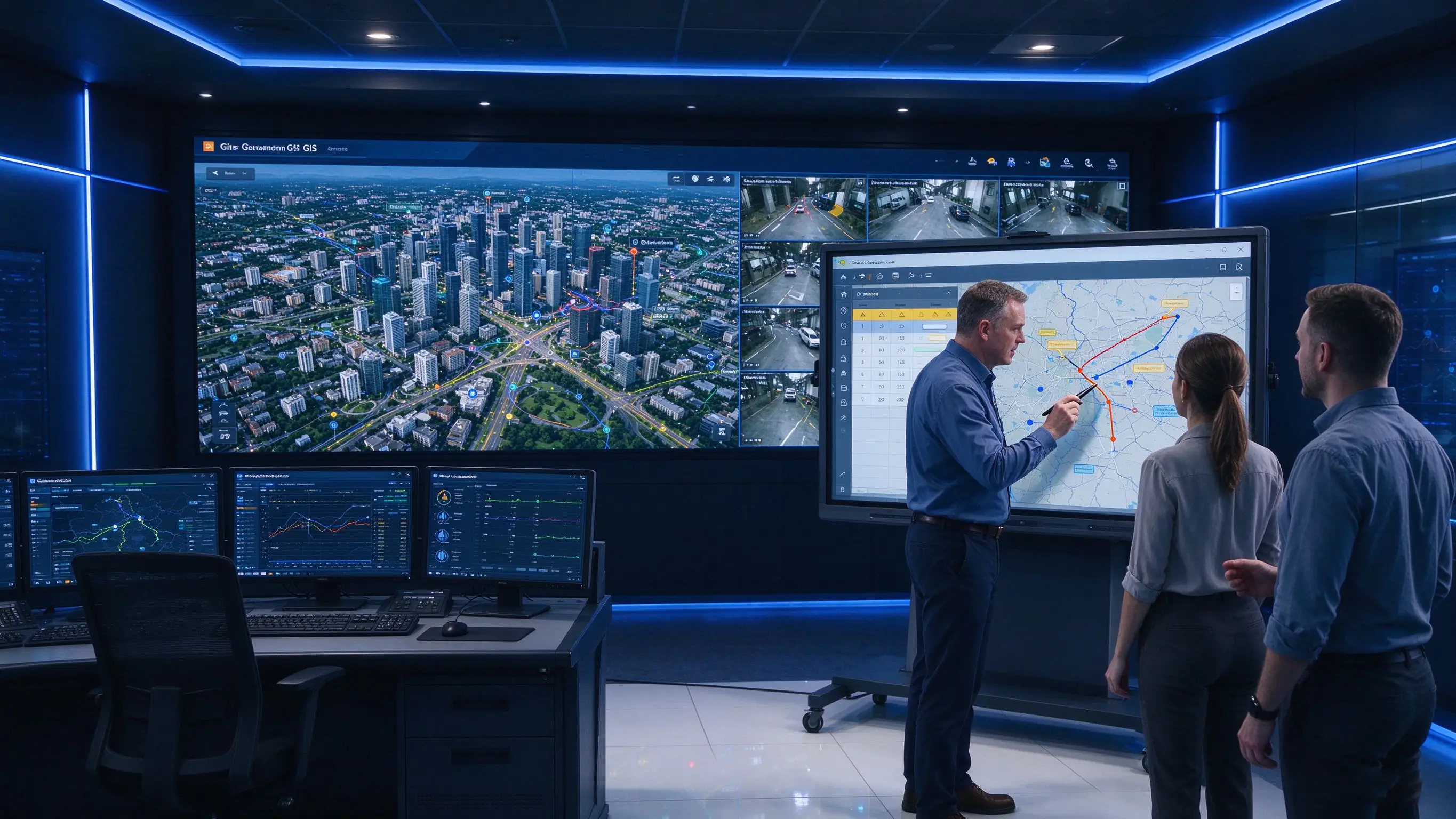
Draw emergency routes, mark risk areas, plan resource deployment, set up shelters, design department division of labor, establish incident handling procedures, and save plan templates for different disaster types. Qtenboard DMS supports batch distribution of plan templates to multiple command centers to ensure that a unified emergency response framework is used in all regions.
View weather and hydrological data, mark key areas, observe traffic and people flow, record potential safety hazards, update resource lists, and visually manage risk levels.
Display the location and scope of the incident, mark the affected area and control line, plan the rescue route and evacuation route, view the scene video, record the latest intelligence, allocate personnel, vehicles and materials, and update the status of the incident. The Qtenboard supports 20-50 touch control, and multiple commanders can operate on a large screen at the same time, and the cooperation efficiency is much higher than that of operating a single workstation in turn.
The fire department provides the rescue progress, the public security provides the traffic and security information, the medical department provides the wounded and the bed situation, the traffic department provides the road status, the public works department provides the infrastructure information, and the commander unifies the summary on the whiteboard. The Qtenboard supports multi-window display, where maps, videos, task boards, and department information can be presented simultaneously on the same screen.
Playback the timeline, compare the plan and actual actions, mark information delays, analyze resource scheduling, record departmental collaboration issues, form improvement tasks, and update the next version of the emergency plan. The Qtenboard supports one-click saving of all annotations and annotations, and complete archiving of event timelines and decision processes.
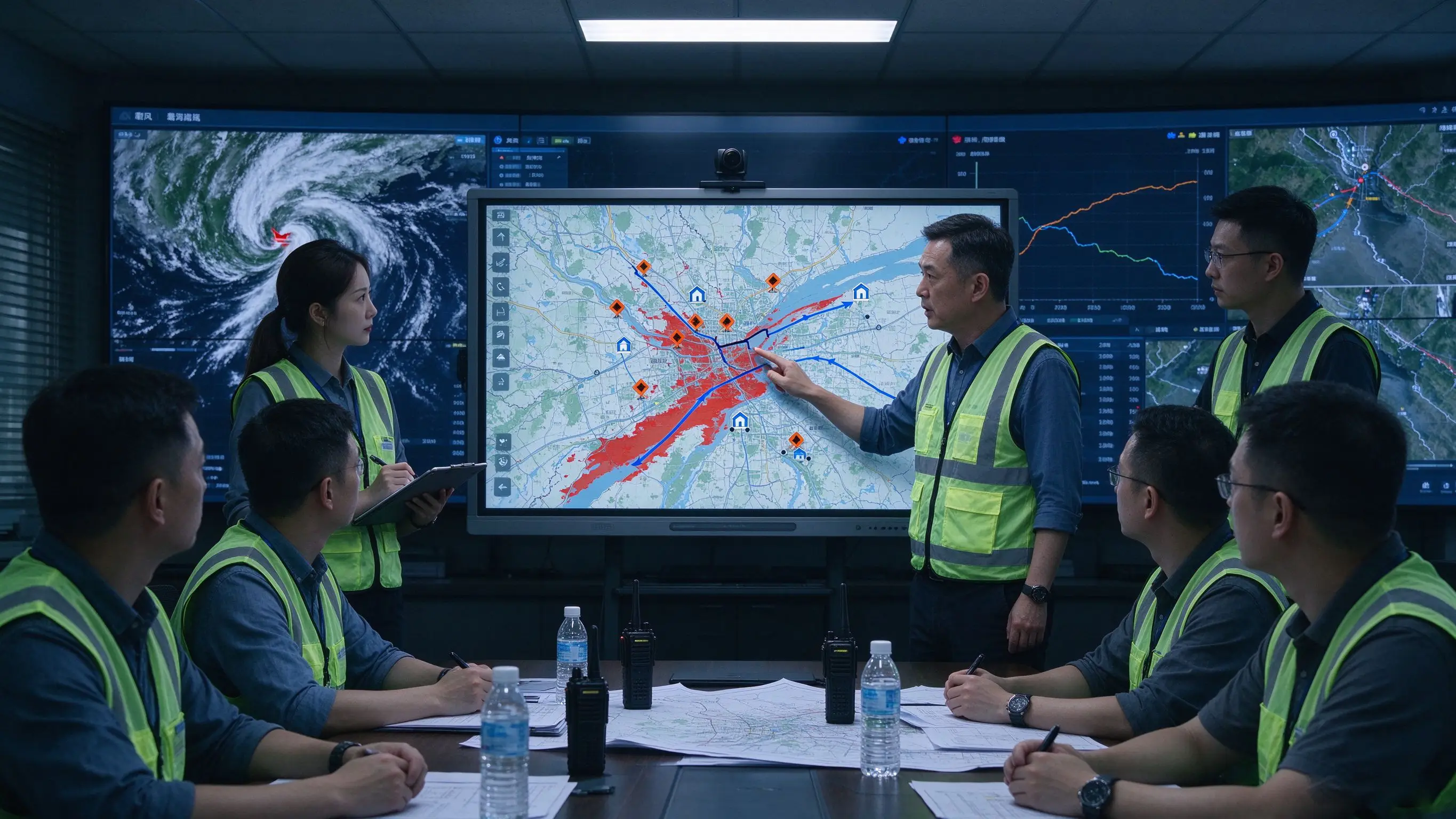
Showable Content:Rainfall and water levels, rivers and low-lying areas, affected roads, evacuation routes, shelters, rescue teams, supplies and vehicles, real-time live video.
Whiteboard Collaboration:Mark hazardous areas, map road closures and evacuation routes, update resource deployment, assign patrol tasks, and record unverified information. Qtenboard 86/98-inch large screen is suitable for the discussion area of the command center to ensure that all command personnel can see the details of the map clearly.
Location of damaged buildings, status of roads and bridges, information on trapped people, location of rescue teams, medical transfer routes, helicopter or special vehicle resources. Interactive whiteboard can be used for on-site information labeling, search and rescue area division and multi-department task coordination.
Fire line or pollution diffusion range, wind direction and weather, high-risk facilities, traffic control area, evacuation route, fire resource allocation, environmental monitoring data.
Case and regional distribution, medical resources, material inventory, detection points and isolation areas, transportation and personnel scheduling, inter-departmental meetings.
Activity areas, people flow heat, entrances and exits, police and medical points, traffic flow lines, emergency plans, live video.
GIS maps, CAD scheduling, surveillance video, meteorological and environmental data, field pictures and videos, telephone and radio information, public and departmental reports.
Mark the information source, distinguish the confirmed, to be verified and wrong information, record the update time, cross-verify the different sources, and mark the uncertain information separately.
Shows the location of the event, superimposes resources, risks and routes to form a unified situation map, adjusts the views of different departments, and saves key time nodes.
Discuss routes and resource allocation, simulate different disposal paths, assess time, risk and impact, access experts and departments remotely, and annotate on maps and flowcharts. In the case of Tamono, Japan, the real-time sharing function connects the tablet computer, local base and evacuation center in the disaster area to ensure accurate and timely communication. Through multi-point connection, video conferencing can be started immediately, images and videos can be shared, and whiteboard can be used to coordinate with the on-site team more effectively [reference:7].
Task content, executive department, site person in charge, completion time, required resources, reporting method and review node. The Q AI supports automatic extraction of action items and 5 seconds to generate a structured task list.
Receive field feedback, update resource status, modify routes, mark completed tasks, handle new risks, and retain decision versions.
Set the background of the event, display the GIS map, gradually release the event information, let the department act according to the plan, record the decision-making time and communication quality, and whether the resumption information is transmitted in time.
Changes in the path of typhoons, rising river water levels, the spread of industrial leaks, large-scale power outages, the chain impact of traffic accidents, and the expansion of public health incidents.
Learn the event management process, train situation judgment, practice resource scheduling, communicate across departments, identify the risk of incomplete information, and master the large screen and software operation of the command center.
Replay the event timeline, compare the plan with the actual response, mark the wrong decision, analyze the information delay, generate improvement items, and update the emergency plan. Q AI meeting intelligence can automatically record the whole process of the exercise and generate structured replay minutes in 5 seconds.
The municipal center connects the district and county centers, the command center connects the on-site team, and multiple departments join remotely, share maps, tasks and videos, and save exercise records. The Qtenboard supports up to 9 devices at the same time, and the Q AI supports real-time subtitles and translation in 166 languages.
The Qtenboard provides a complete emergency command and display product line: 55-110 inch interactive whiteboard, LCD video wall (43-75 inches, splicing gap 8mm to 0mm), digital signage and information publishing equipment, Android Windows OPS dual system, camera/microphone and audio matching, DMS/CMS equipment management. Qtenboard public information shows that its product range includes interactive flat panels, LCD video walls, digital signage and other commercial display devices, which can provide combined display products for governments, command centers and multi-scene projects [reference:8].
Android for whiteboarding, screen projection, browser and basic collaboration. Windows OPS is used for GIS, WebEOC, scheduling systems, Office and professional applications. The dual system is suitable for projects that need to cooperate quickly and run professional command software, and the switching time is less than 3 seconds.
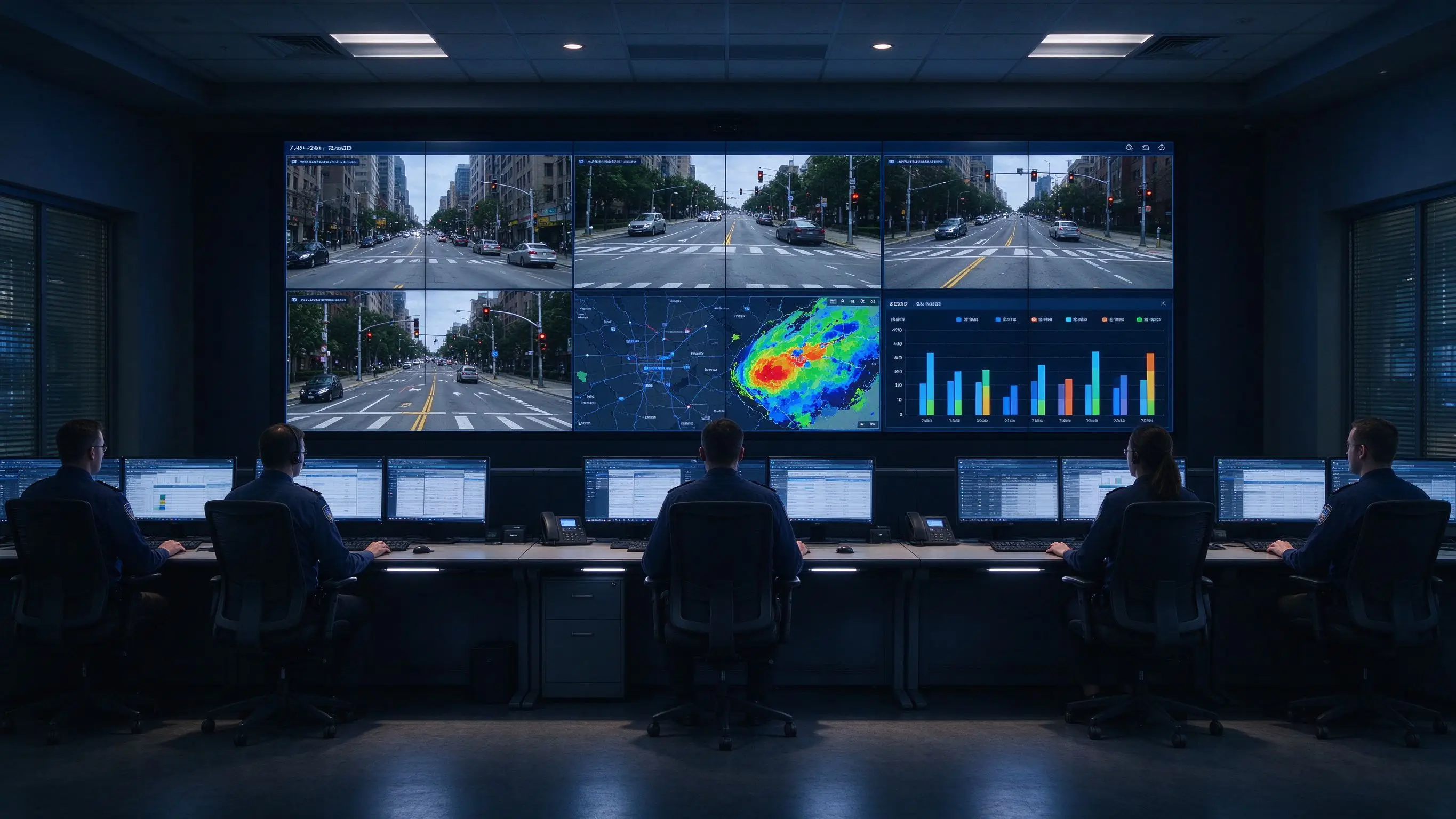
The flood control command center of a city needs to check the river water level, rainfall, ponding points and road conditions at the same time, multi-departments jointly plan evacuation routes and resource deployment, and the district and county centers need remote access.
The deployment plan uses a Qtenboard LCD video wall to display the overall situation of the city, interactive whiteboards are used to mark key areas and routes, GIS and event management systems are run Windows OPS, cameras and microphones are connected to remote meetings, and task kanban records departments and responsible persons. After the deployment, the efficiency of information integration is significantly improved, the route and resource deployment are visualized, the participation of remote departments is more direct, and the integrity of the re-disk materials is greatly improved after the event.
A large-scale activity needs to monitor the flow of people, traffic, medical points and police forces. On-site incidents need to be reported quickly. The command team needs to check maps and videos in a unified way.
After using Qtenboard 86-inch interactive whiteboard, the commander marks congestion and risk points on the large screen, plans evacuation routes, assigns on-site inspection tasks, updates medical resources and traffic plans, and saves decision-making records. Q AI automatically generate activity support minutes, and DMS uniformly manages command center equipment. The situation awareness of the command team has been significantly improved, and the response time to emergencies has been shortened by about 30%.
An emergency management bureau needs to simulate multiple disaster scenarios, train cross-departmental collaboration, and evaluate the response speed and information sharing effect of commanders.
After Qtenboard 98-inch interactive whiteboard is deployed, event templates and situation maps are preset, event information is released in stages, whiteboards are used for joint decision-making, operations and timelines are recorded, and a list of improvements is generated. Q AI automatically records the whole process of the exercise and generates structured resume minutes in 5 seconds. The efficiency of the rehearsal was increased by about 60%, and the standardization of cross-departmental collaboration was significantly improved.
| Indicator category | Traditional method | Qtenboard Programme |
|---|---|---|
| Situation formation time | Rely on oral debriefing, 15-30 minutes | Visual annotation, shortening by more than 50% |
| Task allocation efficiency | Telephone and radio one by one notification | Whiteboard task board, one-time assignment |
| Remote Collaboration | Phone description, incomplete information | 9 devices to screen, real-time sharing of maps and annotations |
| Completeness of compound disc material | Reliance on recordings and notes | Q AI 5 seconds to generate structured resume summary |
| Device Management | Station-by-station maintenance | DMS unified monitoring, predictive diagnostics |
| Signal switching success rate | Manual operation, relying on experience | Preset layout, one key switch |
The data is based on Qtenboard typical emergency command deployment scenarios, and the actual results vary depending on the size of the project and how it is used.
The map is large, but the CAD list, street names, and task status are not visible. Correct approach: according to the minimum text and the farthest viewing distance design. Qtenboard 4K UHD resolution and AG anti-glare glass ensure long-distance readability.
Whiteboards are good for collaboration and annotation, and video walls are good for continuous display of posture and multi-channel monitoring. Correct approach: Use a hierarchical display architecture. Qtenboard offer a portfolio of both interactive whiteboards and LCD video walls.
The command staff saw a lot of information, but did not know who would perform the next step. Correct approach: add task board, responsible person and deadline. The Q AI supports automatic extraction of action items and responsible persons.
Failure of the network, signal source, power supply or controller may affect the situation display. Correct approach: Evaluate critical link redundancy and backup solutions. Qtenboard DMS supports remote monitoring and predictive diagnostics.
Ordinary conference room equipment may not support 7 × 24 hours, complex signals, permissions and security requirements. Correct approach: Reliability, interface and safety testing at project level. Qtenboard LCD video wall supports 7 x 24 hours of uninterrupted monitoring.
The completion of the system installation does not mean that the commander will use it. Correct approach: incorporate desktop deduction, operation training and re-disk mechanism into project delivery.
Can an interactive whiteboard replace a video wall in an emergency command center?
It is usually not completely replaced. The video wall is suitable for continuous display of unified situation and multi-channel monitoring, and the interactive whiteboard is more suitable for map annotation, task planning, remote collaboration and rehearsal. The two can make up a hierarchical display scheme. The Qtenboard provides two products at the same time, which can be combined and configured according to project requirements.
What size interactive whiteboard should the emergency center choose?
Small collaboration rooms can be considered 65 or 75 inches; Medium and large command discussion rooms can be considered 86 or 98 inches; Very large spaces can also evaluate 105/110 inches, video walls or LED schemes. The key is maximum viewing distance and minimum text readability. Qtenboard covers the entire size range from 55 to 110 inches.
Is it possible to display GIS and real-time monitoring?
Can be integrated according to GIS, video platform, signal processor and OPS/workstation configuration. The input interface, resolution, signal delay, window layout, and software compatibility need to be confirmed in advance. Qtenboard Windows OPS supports ArcGIS, WebEOC and other professional platforms.
Does the interactive whiteboard support remote command collaboration?
Remote meetings, map callouts, and task discussions can be supported through cameras, microphones, video conferencing platforms, and digital whiteboards. Qtenboard supports screen mirroring for up to 9 devices simultaneously, and Q AI offers real-time subtitles in 166 languages. When sensitive government or public safety data is involved, the network and permissions need to be reviewed by the project party.
Can Qtenboard provide a video wall and interactive whiteboard combination?
Qtenboard disclosed product range includes interactive flat panels, LCD video walls, digital signage and related OEM/ODM, CKD/SKD capabilities. Video wall, interactive whiteboard, OPS, signal processing, stand, audio and control system combinations can be evaluated on a project-by-project basis. The LCD video wall covers 43-75 inches, the splicing gap is from 8mm to 0mm, and supports 7 × 24 hours of operation. The specific plan shall be confirmed according to the incident management platform and site layout.
Does the Qtenboard device support multi-center unified management?
Support. Qtenboard DMS (Equipment Management System) supports unified monitoring, batch update and permission management of multiple command centers. The IT team can manage all display devices in one background, supporting remote signal source switching, display layout scheduling, device online status tracking, firmware OTA remote upgrade and batch device management. The AI-driven predictive diagnostic module checks hardware parameters such as panel temperature, internal voltage and color values, and provides early warning to avoid unexpected downtime of the equipment during emergency.
If you are planning an emergency command center display system or city operations center project
The Qtenboard provides 55-110 inch interactive whiteboard, LCD video wall (43-75 inches, 8mm-0mm stitching), Q AI system-level framework (166 language, local operation, 5-second minutes), Genio 520 platform (10 TOPS device-side AI, fanless mute design), DMS device management and OEM/ODM/CKD/SKD customization services.
Get a guide to Qtenboard emergency command options, or make an appointment for a factory visit and prototype testing.
 Partner Links:

 en
 中文

 Previous:
 Return to list